i
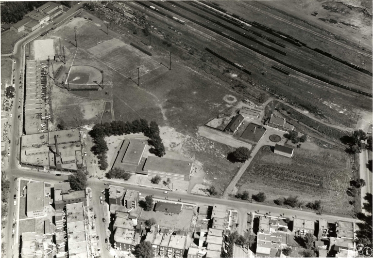
Aerial view of Parc LeBer and Ferme Saint-Gabriel
Photograph : Ville de Montréal, SDCQMVDE © Ville de Montréal, SDCQMVDE, Direction des grands parcs et de la nature en ville (DM5 #134 105)
2. Parc LeBer and the Point
This photograph dates back to the 1940s. In the upper right corner, the St. Lawrence River can be seen. The shoreline moved away from the site following various backfill operations undertaken along the river to create infrastructures such as the Champlain Bridge (1958-1962) and the highways that provide access to it (1967).
The park was given this name in memory of the Le Ber family which had an illustrious history in Montréal in the 17th and 18th centuries and which owned several properties in the Point. This name, which was initially written in two words, was transformed over time into LeBer.

