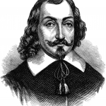
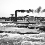
During his first voyage, Jacques Cartier, the famous explorer, travelled up and down the Baie des Chaleurs. The following year, on his second voyage, he went up the river to the village of Hochelaga. Following a visit there, Cartier reached Mount Royal, the main mountain, where he noticed "waterfalls, the most impetuous ones that could be seen, and we were unable to cross them". The description of the Lachine Rapids was immortalized by the famous discoverer.
From Cartier
In 1541, Jacques Cartier managed to get closer to the Grand Sault, but wasn't able to cross it. He tried, with one of his small boats, to go as far as possible. Despite the fact that he doubled the number of men to row it, the current was too strong and the depths, with big boulders, were too perilous. The force of the waterfalls obliged him to portage all along the shoreline of the island. He found a beaten path to resume his voyage. We have reason to believe that this path, opened up by the members of the First Nations, would become Chemin du Roy over the years and then present-day Boulevard LaSalle.
To Roberval
In 1542, Jean-François de la Rocque de Roberval tried but failed to push ahead further in exploring the waterfalls, but alas, he lost eight men and two small boats in the process, swallowed up by the tumultuous waves of the rapids.


